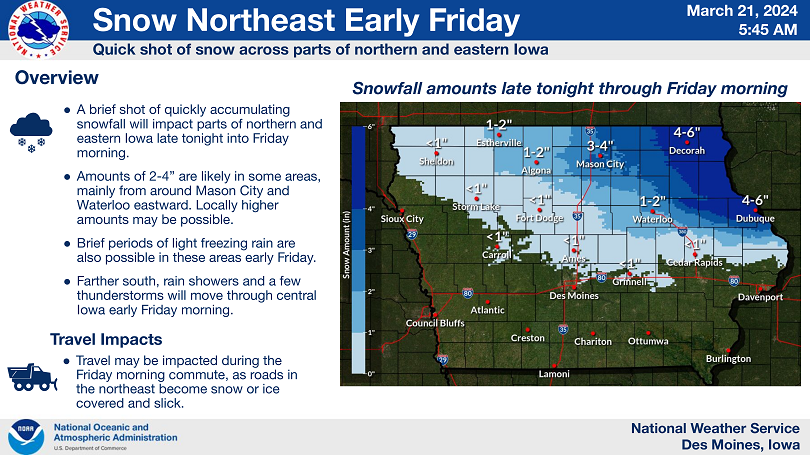
⚠ Winter Weather Returns Tonight And This Weekend ❄☃
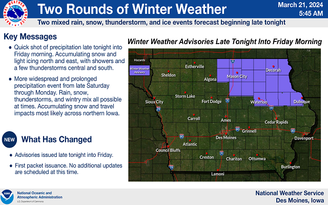
A quick shot of mixed precipitation early Friday, then a more widespread and significant event later this weekend.
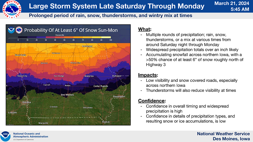
The first system will move through quickly from late tonight into Friday morning. The second storm will spread varying forms of precipitation across Iowa from late Saturday through Monday night.
Much of Iowa will receive precipitation, especially in the second round. Highest chances for snow, ice, and winter impacts will be across northern Iowa in both events, with rain and thunderstorms more likely toward the south.
…WINTER WEATHER ADVISORY IN EFFECT FROM 1 AM TO 10 AM CDT FRIDAY…
* WHAT…Mixed precipitation expected. Total snow accumulations of 2 to 4 inches and ice accumulations of a light glaze.
* WHERE…Portions of northern and northeastern Iowa, including the Waterloo and Mason City areas.
* WHEN…From 1 AM to 10 AM CDT Friday.
* IMPACTS…Plan on slippery conditions and snow covered roads at times. The hazardous conditions could impact the morning commute.
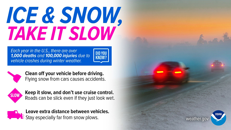
PRECAUTIONARY/PREPAREDNESS ACTIONS…
Slow down and use caution while traveling. For the latest travel conditions, check the Iowa 511 app, www.511ia.org, or dial 511.