THE LATEST: Another Winter Storm This Weekend.

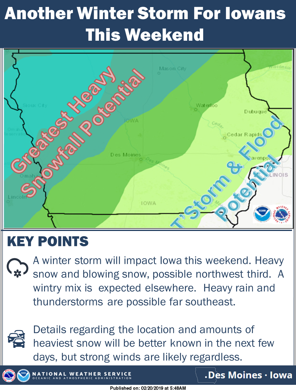 Another strong winter storm is taking shape for late Friday through Sunday morning. Ahead of this storm, warmer air will surge into Iowa potentially bringing rain, freezing rain and even a chance for thunder southeast with snow north. Saturday night, as the storm system lifts out of the region, much colder air will surge into the state on strong northwest winds. Precip will change over to snow from northwest to southeast and may be moderate to heavy at times. The strong wind will likely cause problems as well. Being that this storm is several days out, specific details are still unclear so the forecast will undoubtedly change some in the coming days. However if you have travel plans this weekend, please keep in mind the potential for hazardous weather and monitor forecast changes.