Snow and Blowing Snow Friday and Saturday
January 16, 2020 7:53AM CST

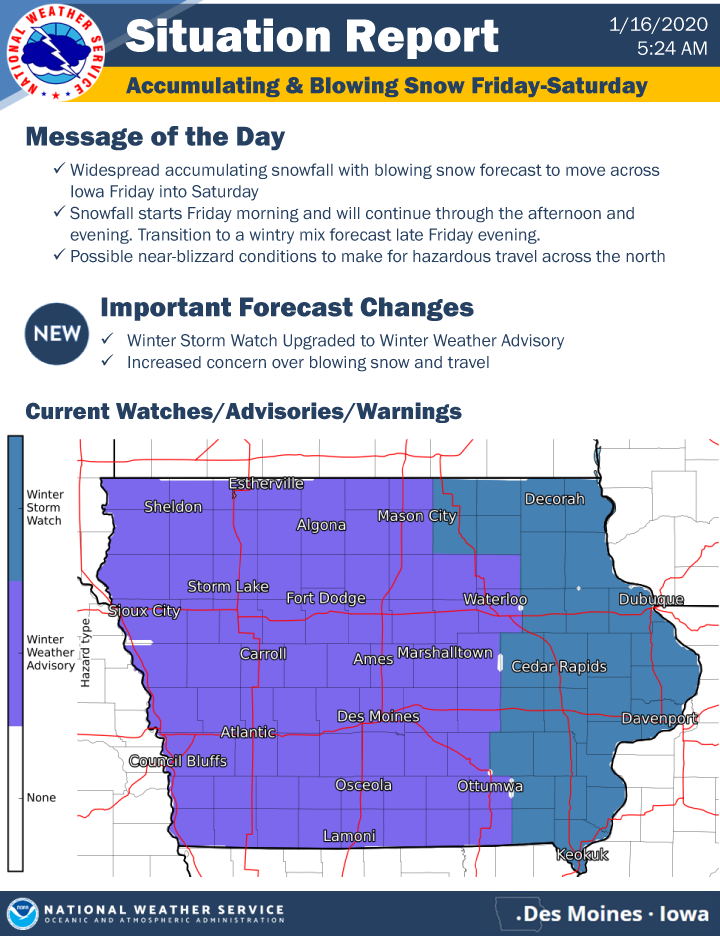
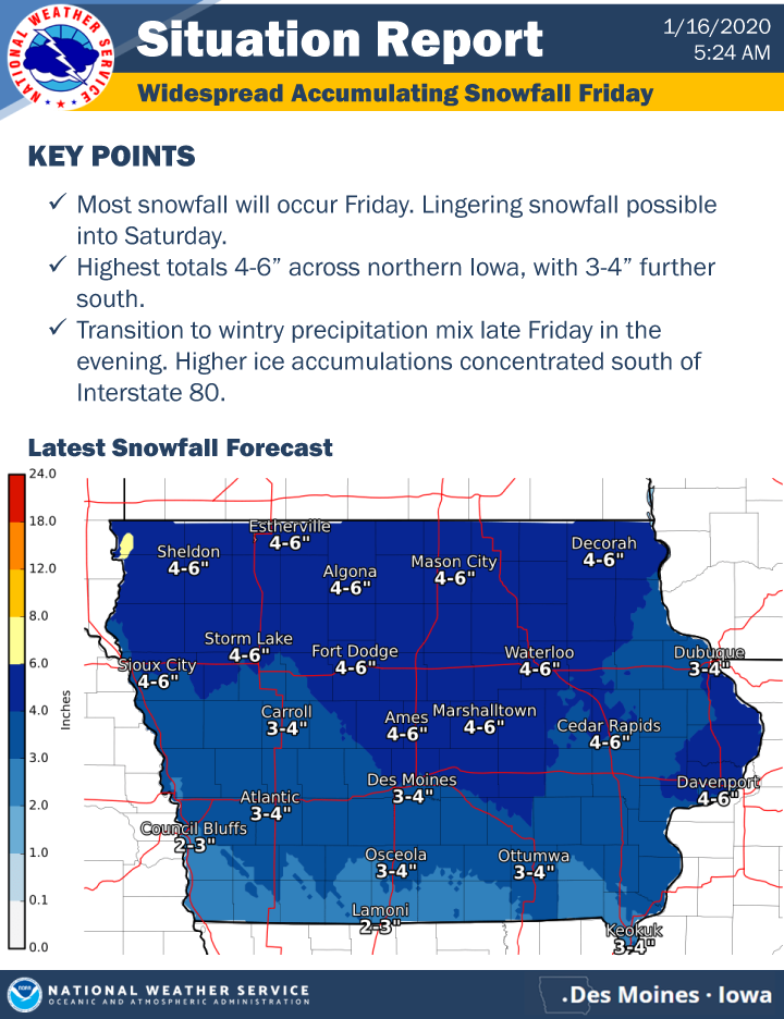
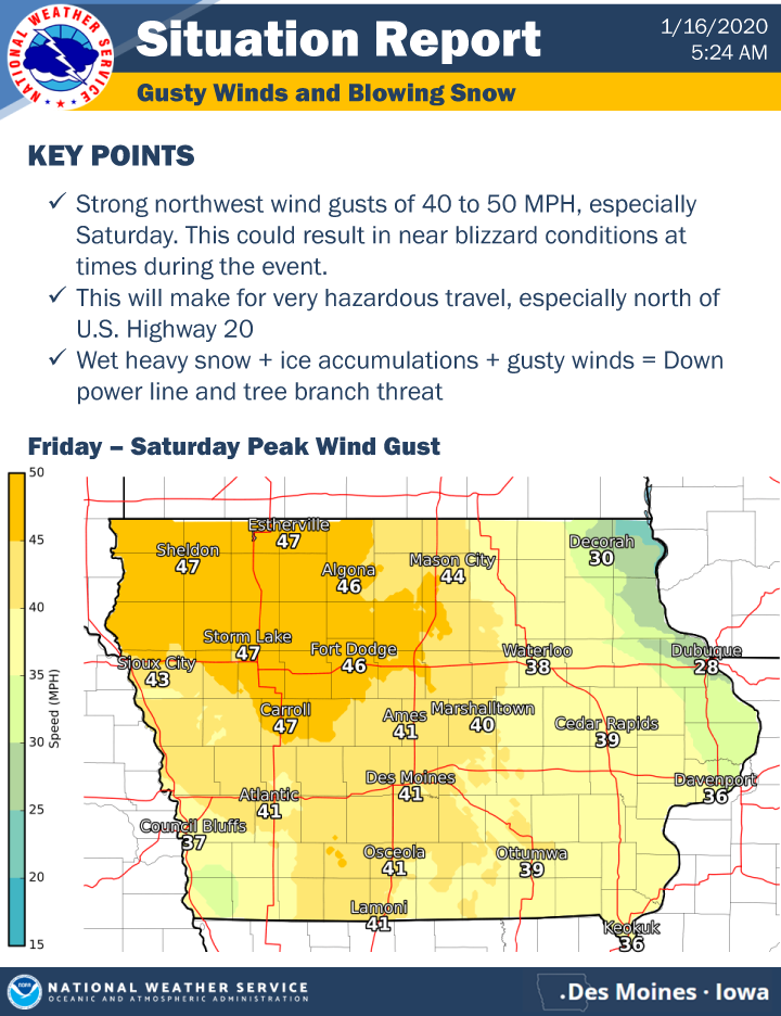
Snowfall returns Friday morning as a strong winter weather system takes aim on the region. The snow may be heavy at times during the morning and afternoon hours before eventually transitioning into a period of light wintry mix or freezing rain. This may create slow and hazardous commutes to and/or from work and school. Highest snowfall accumulations nearing 6 inches will reside in north central Iowa with lesser amounts of 3 to 4 inches further south. Strong northwest winds develop Saturday which could lead to areas of blowing snow, in addition to lingering light snowfall Saturday morning. There is concern for near blizzard conditions across the north at times with this event.