❄Heavy Snow Possible Thursday evening through Friday evening❄
…Accumulating Snowfall with Gusty Winds Thursday night through Friday…
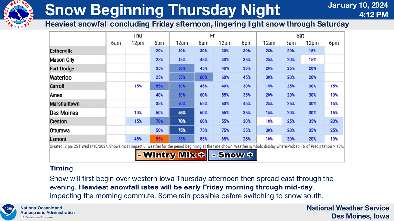
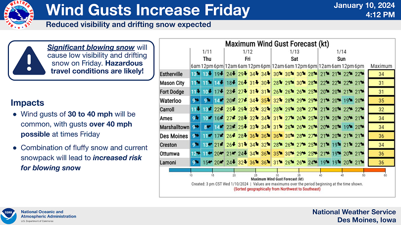
A multi-faceted winter storm will pass through the state starting Thursday night and lasting through Friday. Snowfall amounts from 5 to 10 inches are expected over much of central Iowa along with winds gusting over 40 mph Friday. The combination of gusty winds, snow on the ground from the previous system, and new, fluffy snow falling Thursday night into Friday will lead to a significant blowing snow threat, with near- whiteout conditions and drifting snow possible. Therefore, hazardous travel conditions are expected through much of the state on Friday, including both the morning and evening commutes. Temperatures will also be in the single digits on Friday, with wind chills near and below zero, adding an extra layer of risk to travel on Friday.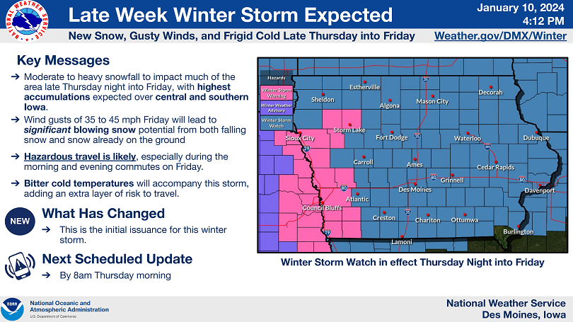
….WINTER STORM WATCH FROM THURSDAY EVENING THROUGH FRIDAY EVENING FOR CERRO GORDO, WORTH, WINNEBAGO, HANCOCK, KOSSUTH, WRIGHT, FRANKLIN AND BUTLER COUNTIES…
Heavy snow is possible. Total snow accumulations of 5 to 10 inches. Wind gusts over 40 mph causing significant blowing and drifting snow.
…WINTER STORM WATCH FROM LATE THURSDAY NIGHT THROUGH SATURDAY MORNING FOR FLOYD, MITCHELL AND MOWER COUNTY IN SOUTHERN MINNESOTA…
Heavy snow is possible. Total snow accumulations of 6 to 10 inches. Winds could gust as high as 30 to 40 mph, resulting in near whiteout conditions at times..
…WINTER STORM WATCH FROM THURSDAY EVENING THROUGH FRIDAY EVENING FOR FREEBORN AND FARIBAULT COUNTIES IN SOUTHERN MINNESOTA…
Heavy snow is possible. Total accumulations of 4 to 7 inches possible. Winds could gust as high as 40 MPH.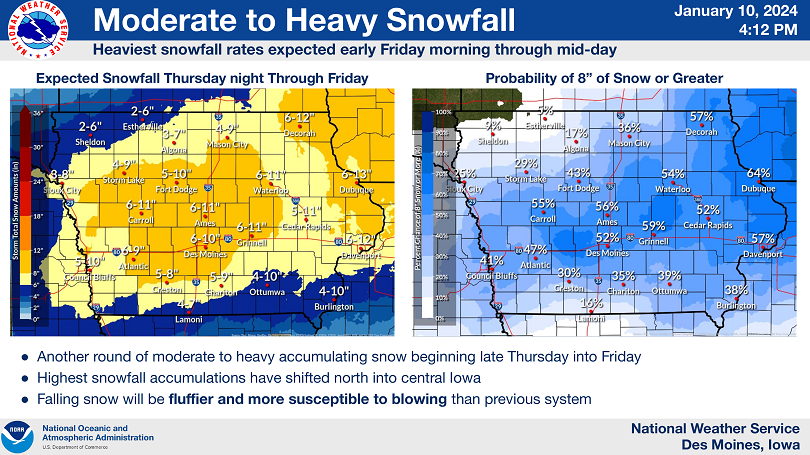
NWS Des Moines