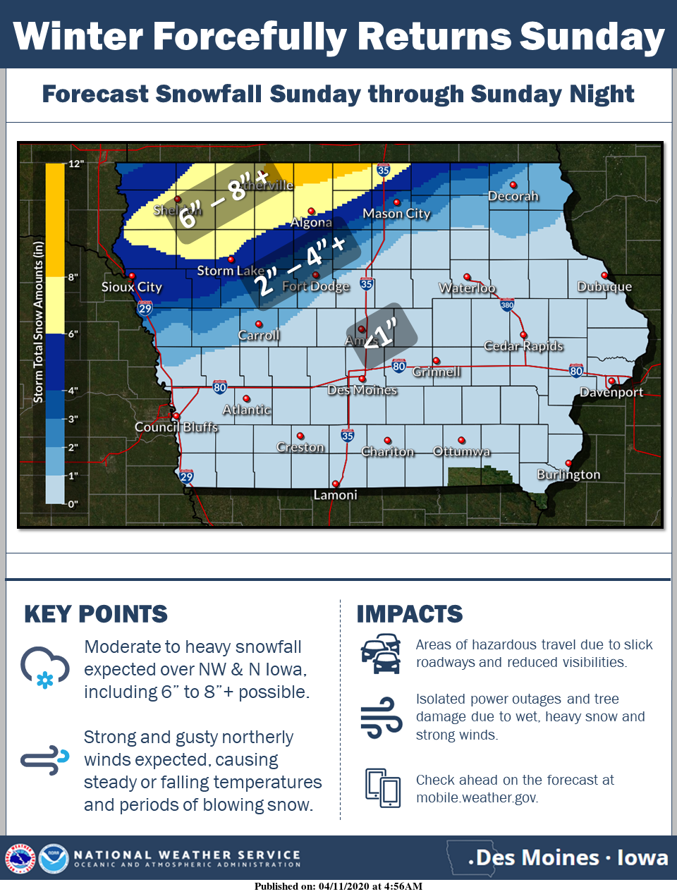
WINTER STORM WATCH remains in effect for portions of North Central Iowa from Sunday Morning through Monday Morning
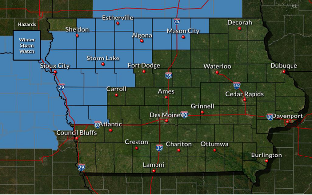
…WINTER STORM WATCH REMAINS IN EFFECT FROM SUNDAY MORNING THROUGH MONDAY MORNING FOR CERRO GORDO, WORTH, WINNEBAGO, HANCOCK AND KOSSUTH COUNTIES…
* WHAT…Heavy snow possible. Total snow accumulations of 5 to 8 inches may be common with locally higher amounts possible. Winds could gust as high as 40 mph.
* WHERE…West Central, Northwest, and North Central Iowa.
* WHEN…From Sunday morning through Monday morning.
* IMPACTS…Roadways should eventually become snow or slush covered. Isolated power outages are possible from gusty winds and or from wet snow causing downed tree branches. Temporary tents may be damaged by the winds or by the weight of the accumulated wet snow.
PRECAUTIONARY/PREPAREDNESS ACTIONS…
Monitor the latest forecasts for updates on this situation.
…WINTER STORM WATCH REMAINS IN EFFECT FROM SUNDAY MORNING THROUGH MONDAY MORNING FOR MITCHELL AND MOWER MN…
* WHAT…Heavy snow possible. Total snow accumulations of 4 to 9 inches possible. Winds could gust as high as 35 mph.
* WHERE…Portions of west central Wisconsin, north central Iowa and southeast Minnesota.
* WHEN…From Sunday morning through Monday morning.
* IMPACTS…Travel could be very difficult. The hazardous conditions could impact the Monday morning commute.
* ADDITIONAL DETAILS…Blowing and drifting snow could also occur Sunday afternoon into Monday, leading to poor visibility at times.
PRECAUTIONARY/PREPAREDNESS ACTIONS…
Monitor the latest forecasts for updates on this situation.
…WINTER STORM WATCH REMAINS IN EFFECT FROM SUNDAY MORNING THROUGH MONDAY MORNING FOR FARIBAULT MN AND FREEBORN MN…
* WHAT…Heavy snow possible. Total snow accumulations of 5 to 9 inches possible. Winds could gust as high as 35 mph.
* WHERE…Portions of west central Wisconsin and east central, south central and southeast Minnesota.
* WHEN…From Sunday morning through Monday morning.
* IMPACTS…Travel could be very difficult. Patchy blowing snow could significantly reduce visibility. Due to the heavy, wet nature of the snow, tree damage and power outages could occur.
PRECAUTIONARY/PREPAREDNESS ACTIONS…
Monitor the latest forecasts for updates on this situation.