WINTER STORM WATCH from Friday morning through late Friday night
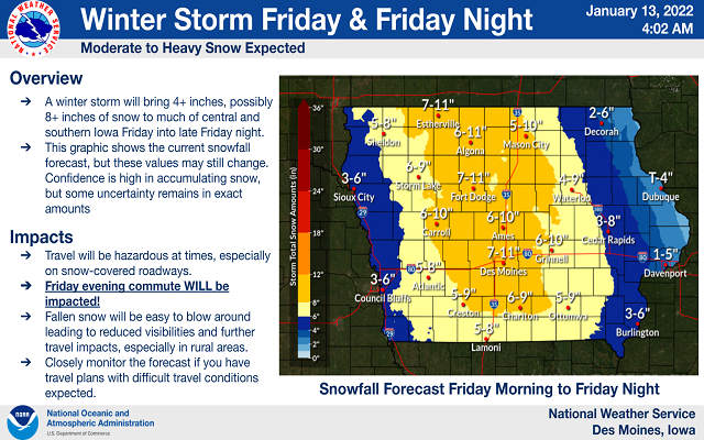
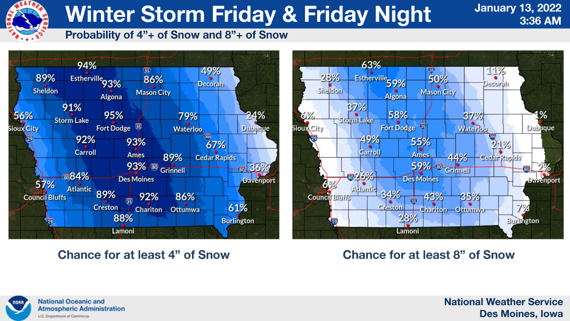
A Winter Storm is expected to bring heavy snow to much northern Iowa and southern Minnesota on Friday. Total snow accumulations of 5 to 10 inches possible with locally higher amounts possible.
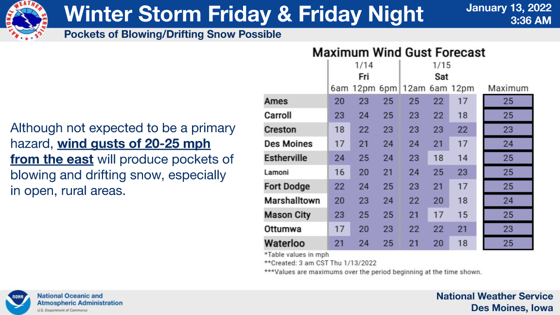
Winds will produce areas of blowing and drifting snow, especially in open rural areas.

…WINTER STORM WATCH FROM FRIDAY MORNING THROUGH LATE FRIDAY NIGHT FOR CERRO GORDO, WINNEBAGO, HANCOCK, KOSSUTH, WRIGHT, FRANKLIN AND BUTLER COUNTIES…
Heavy snow is possible. Total snow accumulations of 5 to 10 inches possible with locally higher amounts possible.
…WINTER STORM WATCH FROM FRIDAY MORNING THROUGH LATE FRIDAY NIGHT FOR WORTH COUNTY…
Heavy snow is possible. Total snow accumulations of 5 to 8 inches possible.
…WINTER STORM WATCH IN EFFECT FROM FRIDAY MORNING THROUGH LATE FRIDAY NIGHT FOR FLOYD AND MITCHELL COUNTIES…
Heavy snow is possible. Total snow accumulations of 4 to 8 inches possible.
…WINTER STORM WATCH IN EFFECT FROM LATE TONIGHT THROUGH FRIDAY EVENING FOR FREEBORN COUNTY IN SOUTHERN MINNESOTA…
Heavy snow is possible. Total snow accumulations of 4 to 7 inches possible.
…WINTER STORM WATCH NOW IN EFFECT FROM LATE THURSDAY NIGHT THROUGH FRIDAY EVENING FOR FARIBAULT COUNTY IN SOUTHERN MINNESOTA…
Heavy snow is possible. Total snow accumulations of 6 to 12 inches possible.


For the latest weather information and the complete county by county breakdown from the National Weather Service in Des Moines, click below!