Winter Storm Sunday Night Into Monday
January 25, 2019 8:02AM CST


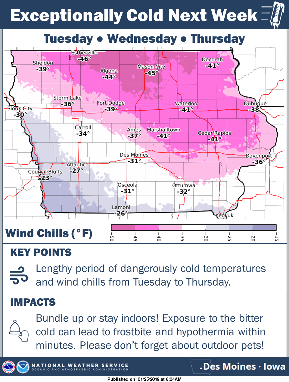
Yet more snow and even a wintry mix is forecast Sunday night into Monday across much of Iowa. The greatest potential for moderate to heavy snow is located over north-central to northeast Iowa, while further southwest a wintry mix is anticipated. There remains some uncertainty in the snow amounts along the southwest edge of the snow band due to the wintry mix possibility Sunday night. Strong northwest winds develop Monday morning and will likely cause blowing and drifting snow throughout the day and even into Monday night. Then, bitter cold temperatures and wind chills are anticipated throughout the work week next week.