❄Snow, Heavy At Times Thursday Into Friday❄
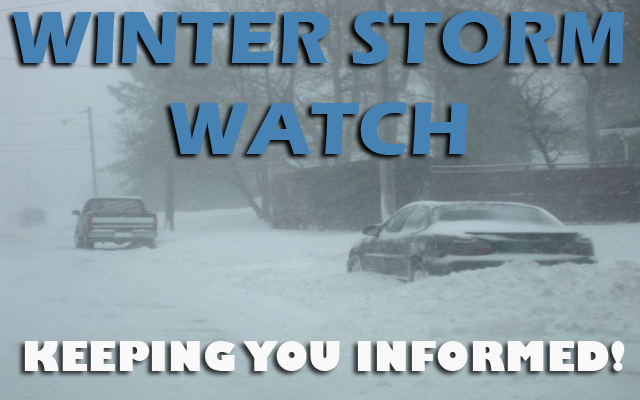
…Heavy Snowfall Expected Across Portions of Northern Iowa Thursday into Friday…
A winter storm is expected to impact Iowa later this week. The highest snowfall totals are expected in the northern third of the state. Totals diminish further south where rain becomes more likely.
While the heaviest snow doesn’t start until Thursday afternoon, there will be intermittent light rain and snow beginning late tonight into Wednesday night but with only minor amounts expected.
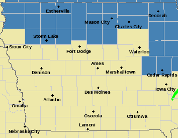
….WINTER STORM WATCH FROM THURSDAY AFTERNOON THROUGH LATE THURSDAY NIGHT FOR CERRO GORDO, WORTH, WINNEBAGO, HANCOCK, WRIGHT, KOSSUTH AND FRANKLIN COUNTIES…
Heavy snow is possible. Total snow accumulations of 5 to 8 inches possible. Strong winds may produce blowing snow as well, reducing visibilities.
…WINTER STORM WATCH FROM THURSDAY AFTERNOON THROUGH LATE THURSDAY NIGHT FOR FLOYD, MITCHELL AND MOWER MN…
Heavy snow is possible. Total snow accumulations of 7 to 10 inches possible.
….WINTER STORM WATCH FROM THURSDAY AFTERNOON THROUGH FRIDAY MORNING FOR FARIBAULT AND FREEBORN COUNTIES IN SOUTHERN MINNESOTA…
Heavy snow is possible. Total snow accumulations of 4 to 7 inches possible.
Travel could be very difficult. Patchy blowing snow could significantly reduce visibility. The hazardous conditions could impact the evening commute.