Severe Thunderstorms Possible Tonight
August 14, 2020 8:27AM CDT
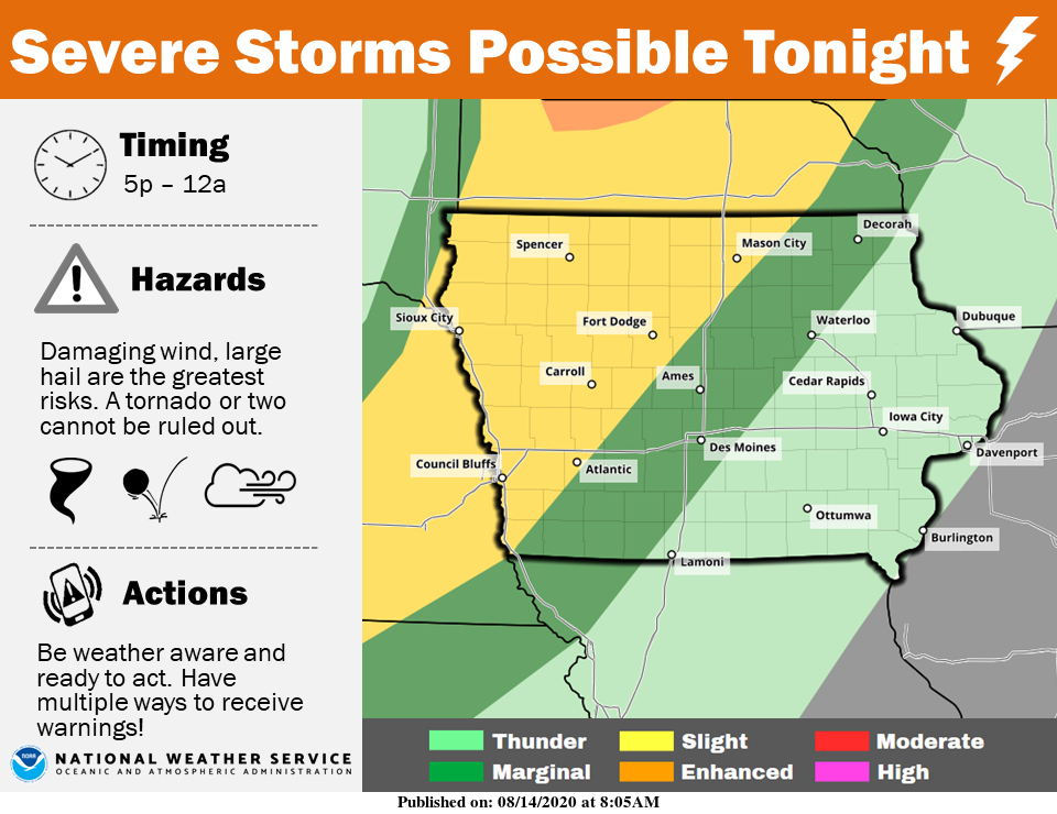
Today will be seasonably warm and humid ahead of a cold front that will be the focus for thunderstorms later today into tonight. Storms are expected to develop over northwestern Iowa and could turn severe with the primary threats being damaging wind gusts and large hail. A tornado or two cannot be ruled out either. As these storms move southeastward this evening and overnight, they will weaken and be moving out of Iowa Saturday morning. In the wake of the front, cooler and less humid air will arrive for Saturday with dry conditions expected through the rest of the weekend.