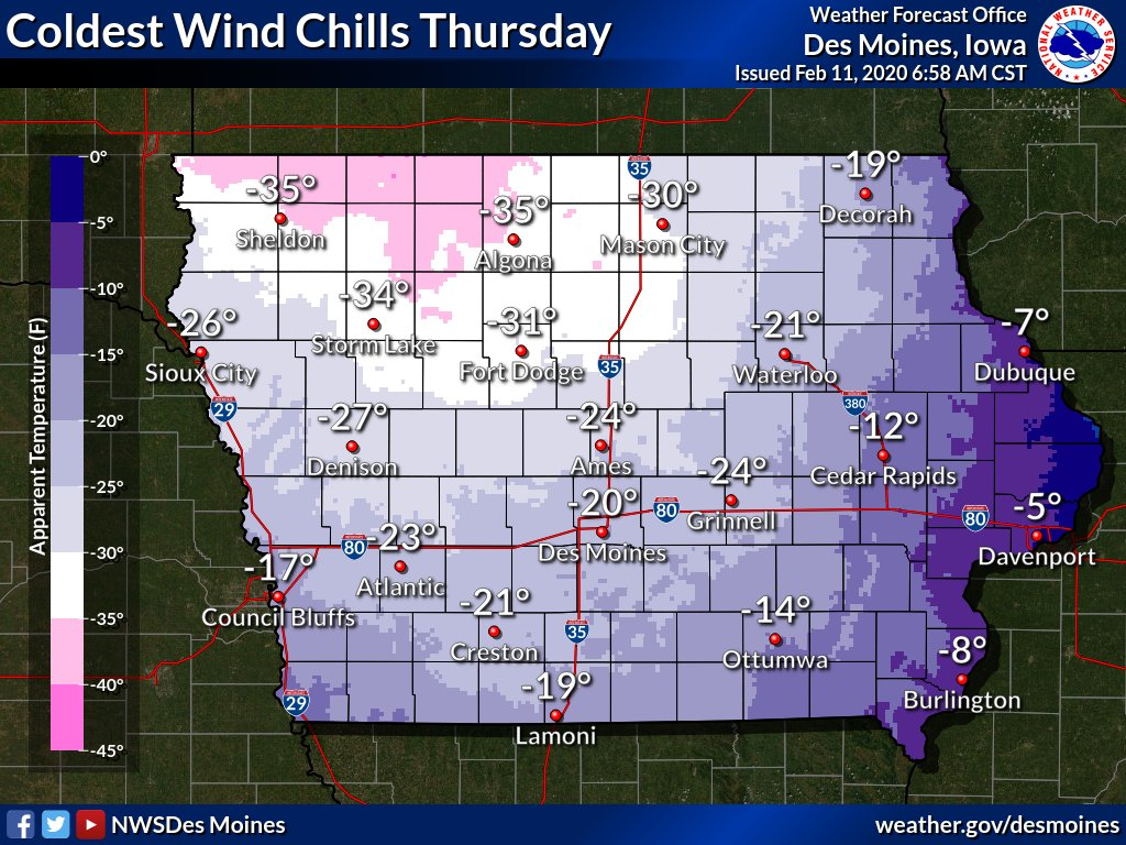
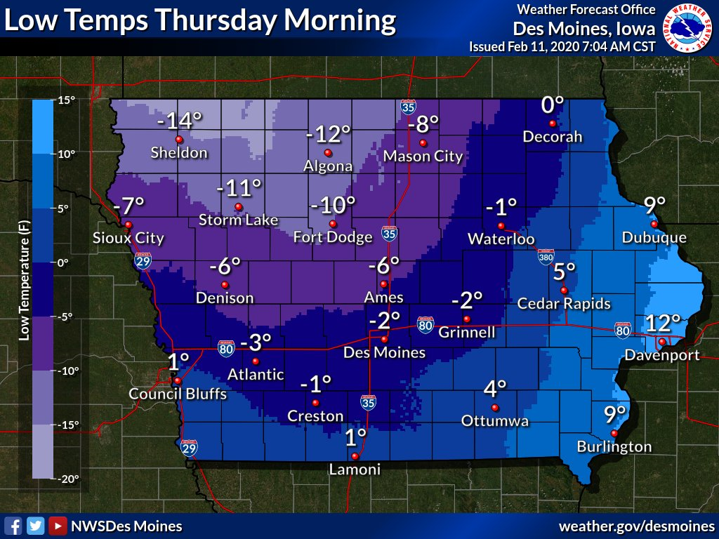
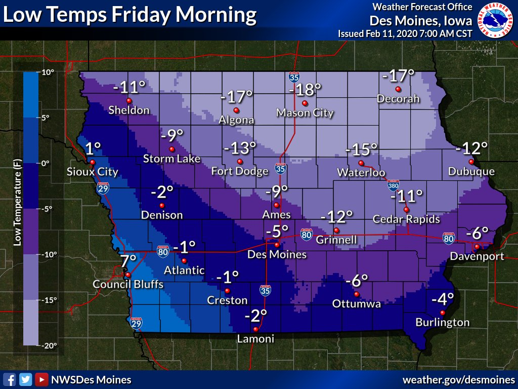
Bitter Cold Thursday and Friday
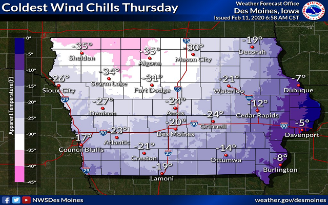
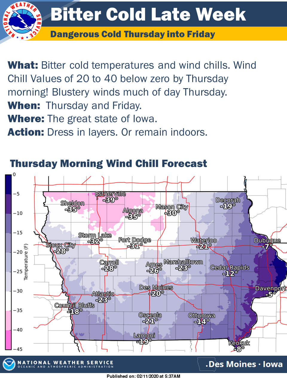
A sharp cold front is forecast to sweep across the state Wednesday afternoon into the evening from northwest to southeast. Ahead of the cold front, accumulating snow is likely to fall across southern to southeast portions of Iowa and temperatures during the day Wednesday look to teeter just above freezing causing some melting. Now with the strong cold front, there will be some light snow fall but the main concern is the rapidly dropping temperatures Wednesday afternoon and evening. The combination of the wet and slushy roads and the temperatures quickly dropping could lead to a flash freeze on roads and thus icy and slick road conditions by Wednesday evening. Bitter cold temperatures and blustery northwest winds are forecast to produce wind chill values of 20 to near 40 below zero by Thursday morning. The blustery winds are likely to persists for much of the day Thursday and then diminish by Thursday evening. Expect low temperatures by Friday morning to bottom out from near 20 below zero across northern Iowa to around 5 below zero over the south.