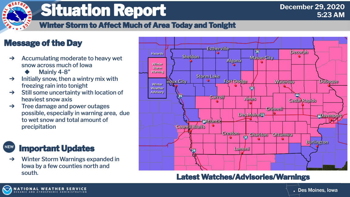
A WINTER STORM WARNING and WINTER WEATHER ADVISORY are in effect for northern Iowa and southern Minnesota Tuesday into Wednesday
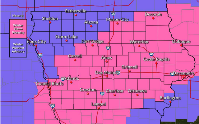
WINTER STORM WARNING IN EFFECT UNTIL 6 AM CST WEDNESDAY FOR CERRO GORDO COUNTY…
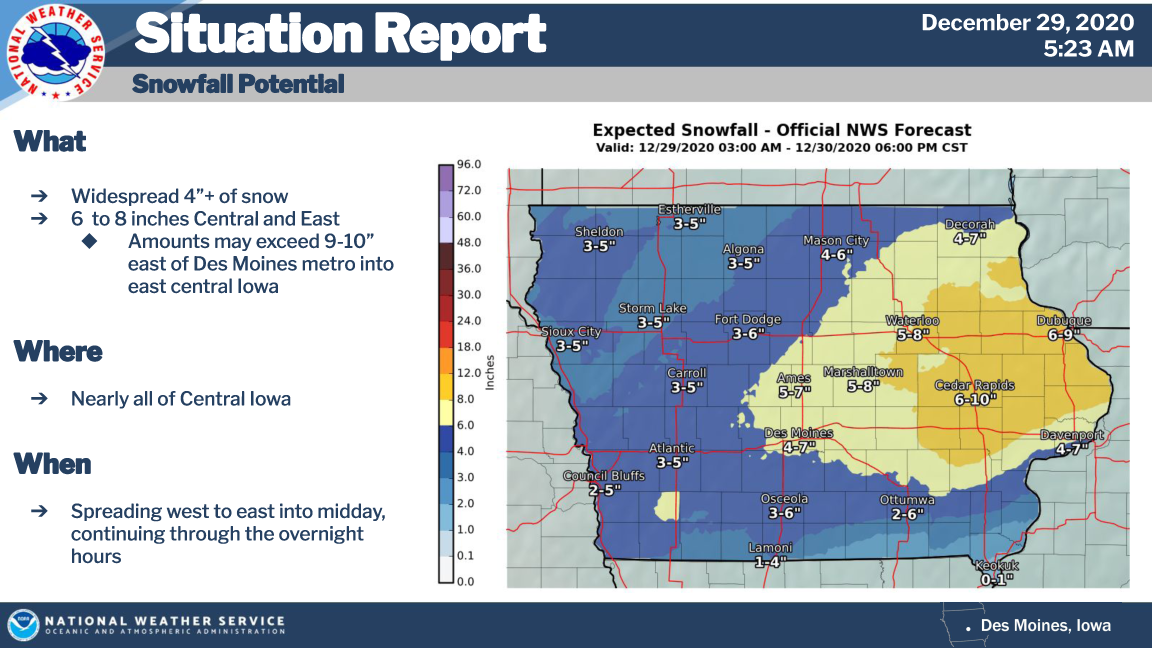
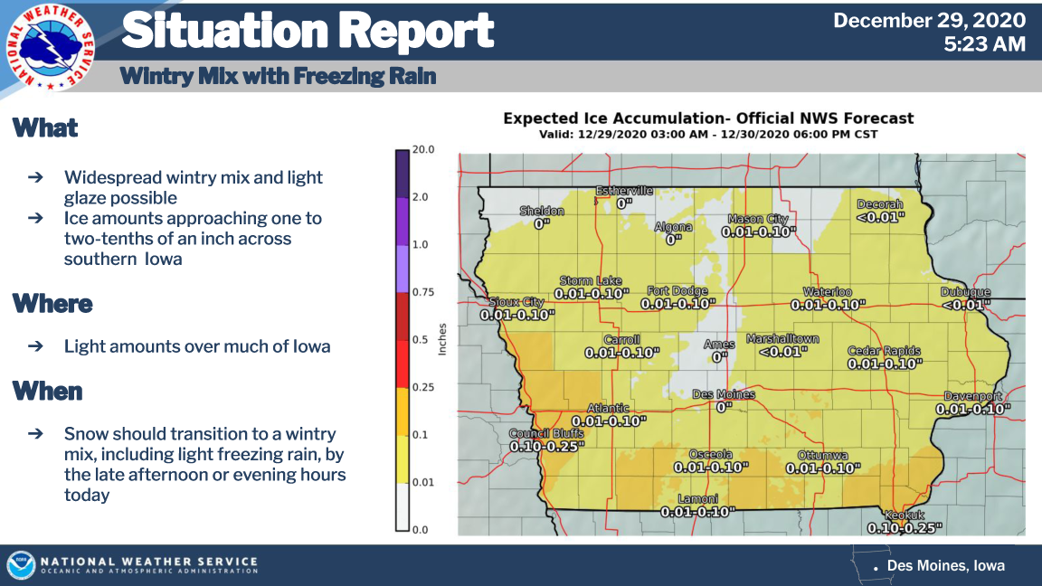
Mixed precipitation expected. Total snow accumulations of 4 to 6 inches, followed by a wintry mix and ice accumulations of a light glaze.
WINTER STORM WARNING IN EFFECT UNTIL 6 AM CST WEDNESDAY FOR WRIGHT, FRANKLIN AND BUTLER COUNTIES…
Heavy snow expected. Total snow accumulations of 5 to 8 inches with locally higher amounts possible. The highest end of that range will be in central Iowa. Wintry mix and ice accumulations less than a tenth of an inch following the snow.
WINTER STORM WARNING IN EFFECT UNTIL NOON CST WEDNESDAY FOR FLOYD COUNTY…
Heavy snow expected. Total snow accumulations of 6 to 10 inches and ice accumulations of a light glaze.
..WINTER WEATHER ADVISORY IN EFFECT UNTIL 6 AM CST WEDNESDAY FOR WORTH, WINNEBAGO, HANCOCK AND KOSSUTH COUNTIES…
Mixed precipitation expected. Total snow accumulations of 4 to 6 inches, followed by a wintry mix and ice accumulations of a light glaze.
…WINTER WEATHER ADVISORY IN EFFECT UNTIL NOON CST WEDNESDAY FOR MOWER MN AND MITCHELL COUNTY IOWA…
Snow expected. Total snow accumulations of 3 to 6 inches.
WINTER WEATHER ADVISORY IN EFFECT UNTIL 6 AM CST WEDNESDAY FOR FREEBORN AND FAIRBAULT MN…
Snow expected. Total snow accumulations of 3 to 5 inches.
For the complete county by county breakdown click on the “Alerts” below!